Flight to Paris…Then and Now.
Flight to Paris…Then and Now.
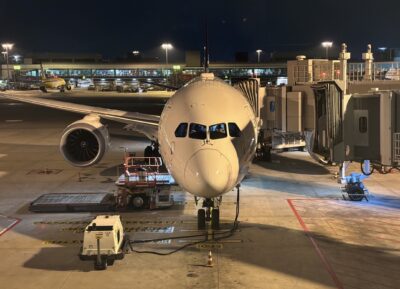
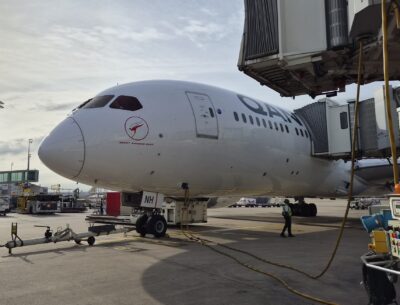
As I write this, I am at 38,000 feet in the “crew rest” of a Boeing 787, weaving my way to Paris from Singapore. 24 years ago, my first flight in Qantas was to Paris and yet while the planet beneath me remains fundamentally the same, a great deal has changed.
Such flights were characterised by long printed flight plans of 10 pages or more. The top section would be carefully folded to display the various topic titles, while the navigation log could be longer than I was tall. Many a pilot sweated on the mathematical outcome of the estimated time of arrival, adding the flight time for each interval, only to discover that a mistake had been made – usually on page two. As the Boeing 747 cut through the night, hands clasped headphones to the ears as one struggled to understand the various dialects of controllers through the crackling of the HF radio. Pale blue and white paper charts were folded to display the airway being flown and the boundaries of the current airspace. One by one, they would be folded away, placed in the sizeable bag on the flight deck and a new chart organised for the flight’s next chapter. Many pilots carried their own atlas, moving an adhesive arrow across its pages to indicate the latest position as the flight progressed. It was a far cry from when my father had to navigate the Pacific Ocean by reference to the stars or even when I started flying jets and Inertial Reference Systems (IRS) lacked the precision of GPS and round dials, not screens, filled the flight deck.

Today, I am able to write this post directly to my website as WiFi is now accessible in the stratosphere. With the rare exception, the vagaries of HF radio have been replaced by the silent satellite communication of CPDLC. Perhaps one of the most significant changes is in the form of the iPad. It has not only replaced reams of paper but allows flight planning to begin before the pilots ever arrive at the airport. The wealth of information that is available at the fingertips is not only extensive but it is in real time and frequently updated. Global weather, NOTAMs, satellite imagery, anticipated radio frequencies, airspace restrictions, winds aloft and much more paints an incredible picture of the route to be flown. And on entering the departure time in the appropriate box, the 10-page arithmetic exercise becomes a thing of the past. All the while, the GPS keeps us precisely on track, although the brave new world below has some parties interfering with the signal, meaning that we revert to the tried and tested Inertial Reference System as we transit their airspace. Similarly, in the interests of safety, we give a wide berth to those areas where conflicts rage below.

I ponder where the technology will lead the next generation of pilots in the years ahead. To what extent will automation change what we consider to be piloting? Even in the span of my 40-year career, that change has been enormous, and the growth of technology seems to be far beyond linear these days. Such thoughts were left in the crew rest as I aligned with runway “8 Left” for the final approach and landing at Charles de Gaulle Airport in Paris. As I fly down the ILS approach with all of the modern tools at my disposal, from the “Head Up Guidance System” to the autopilot and autothrottle, another airport catches my eye out to the right. There are multiple criss-crossing runways with one emblazoned with, “AEROPORT DE PARIS LE BOURGET”.
The significance of that airport is not lost on me. That is the very spot where Charles Lindbergh landed in 1927 after his solo crossing of the Atlantic.
RECENT POSTS


